Animation by Reena Devani
Maps
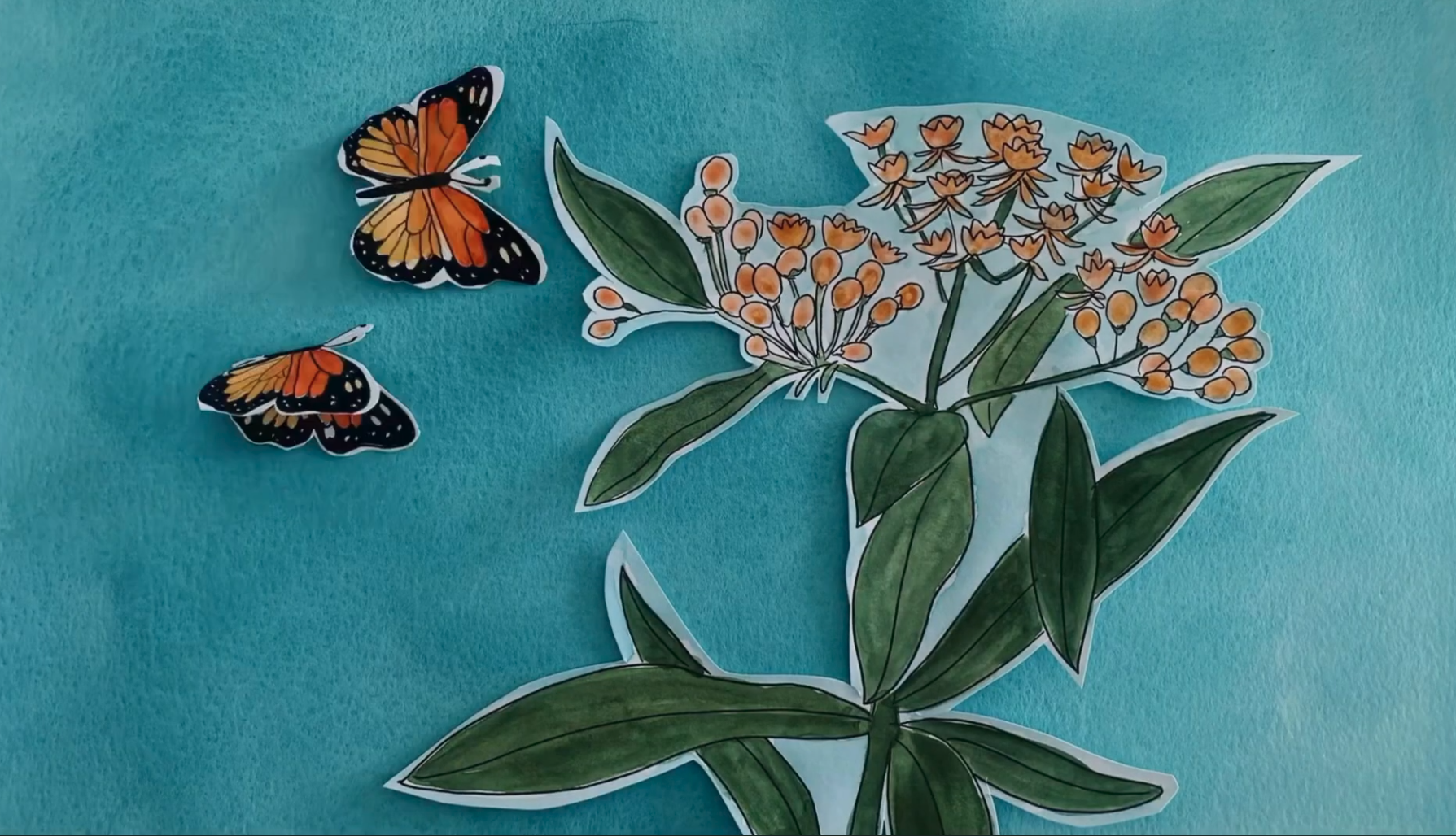
Along the Creek, Along the Sky
An animated film and an interactive map about Etobicoke Creek
Runway Rivers
Daylighting the lost waterways beneath Downsview Airport.
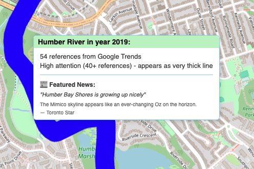
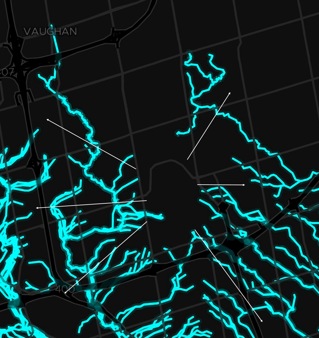
Which Waters Matter?
Media Attention to Toronto's Waterways (2010–2025)
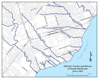
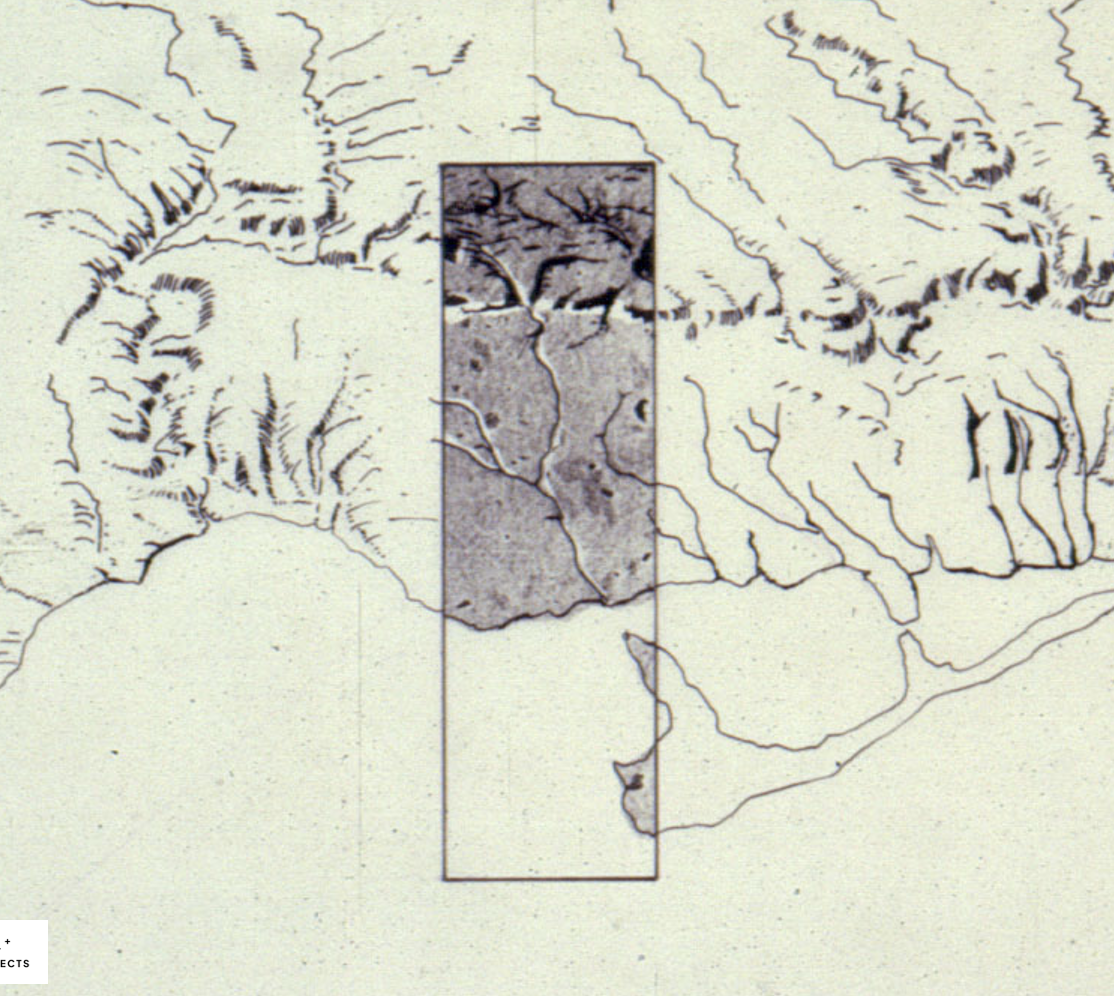
Lost Creeks of South Etobicoke
The history and restoration of buried waterways in southwest Toronto.
Garrison Creek - Buried Alive
Tracing the route of the buried Garrison Ravine
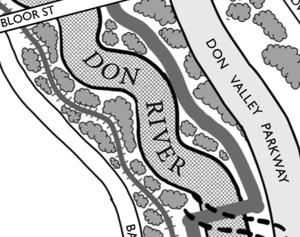
A People's Map of the Don River
Investigating the histories and geographies of the Wonscontonach/Don River.
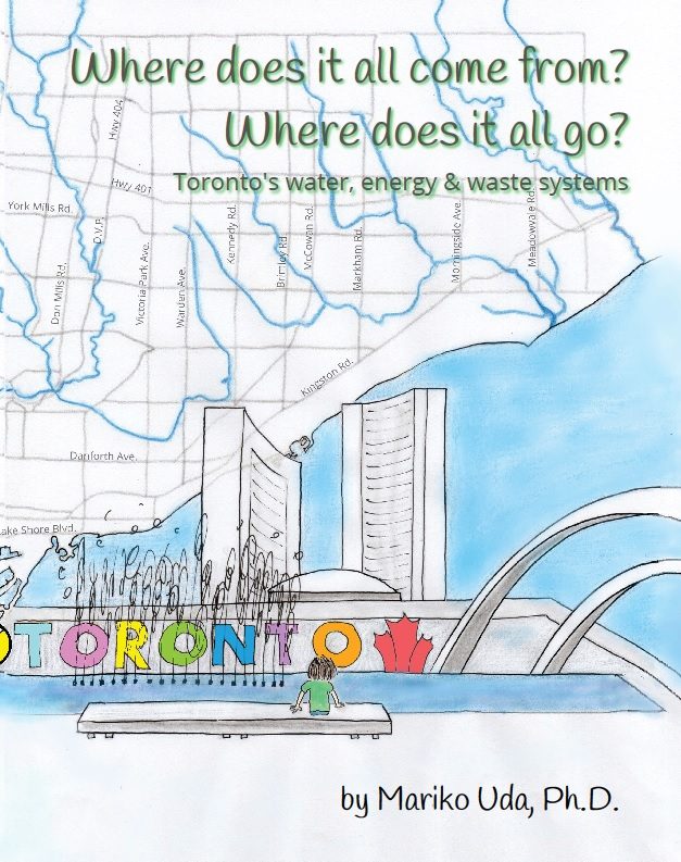
Where does it all come from? Where does it all go?
Toronto’s water, energy, and waste systems
Surfacing Volunteer Organizations working on Water
An interactive map of the GTA region
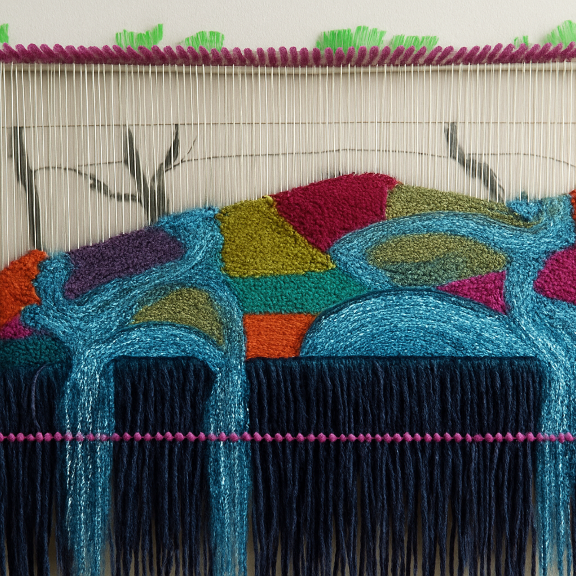
Waters That Weave Through The City
Tracing the threads of water's movement
Collaborators


Acknowledgements
We wish to acknowledge the lands and waters on which The Toronto Water Atlas is situated. Tkaronto sits within interconnected watersheds, shaped by longstanding relationships with water as living, relational, and shared. This place has long been cared for by Indigenous peoples, including the Mississaugas of the Credit, the Anishnabeg, the Chippewa, the Haudenosaunee and the Wendat. We recognize the many traditions of stewardship, mapping, storytelling, and collective care that have sustained these lands and waters over time, and we acknowledge that this project is indebted to those ongoing memories, practices and responsibilities.
We extend our sincere thanks to all the participants who generously shared their time, and enthusiasm during our workshops. Their insights were instrumental in shaping the depth and perspective of this work, and we are truly grateful for their meaningful contributions and continued engagement. We also thank the Centre for Social Innovation (CSI) for hosting us, and Amelia Lee Dogan, Mariko Uda and Dashiel Carrera for leading and facilitating thoughtful and engaging workshops.
Contribute to the Atlas
Please express interest in adding your map to the atlas by emailing us!